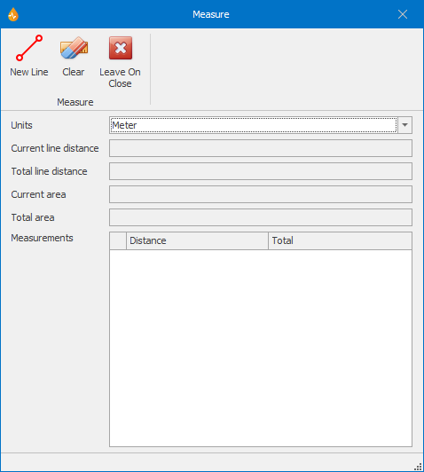
Measure dialog
This dialog allows users to measure distance and areas on the map. Multiple lines and areas are supported.
The dialog is displayed when Measure is selected from the Measure group of the Map tab.
|
Item |
Description |
||||||
|---|---|---|---|---|---|---|---|
| Ribbon |
|
||||||
|
Units |
Dropdown box containing the available measurement units. By default this box will show the units used by the current projection system, but this can be changed if required. |
||||||
| Current line distance |
Displays the current distance measured - from the last clicked point to the current position of the cursor. |
||||||
| Total line distance | Displays the total distance measured over all lines. | ||||||
| Current area |
Displays the area of the current measurement polygon. Tip: You complete a measurement polygon by double-clicking its start point. |
||||||
| Total area | Displays the area of all measurement polygons. | ||||||
|
Measurements |
Note: Separate entries are created within this grid for each contiguous line drawn.
|

