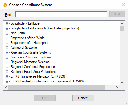
Choose Coordinate System dialog
This dialog allows configuration and customisation of map or layer projection system.
The dialog is displayed when:
- the Edit button is clicked on the Select Network dialog for a selected network or all networks. (The Select Network dialog is launched when the ellipsis button to the right of the Projection field of the Application dialog (Map section) is clicked on).
- the ellipsis button, to the right of the Projection field of the Map Designer (Projection section), is clicked on.
- the ellipsis button in the GPS Conversion section of the GPS Information dialog or GPS Setup dialog is clicked on. It is also displayed when the Use applications current network map projection box is unchecked in these dialogs.
Tip: When the projection system is set at application level (first bullet point), it means that all the maps and layers created within the application will have that projection system as a default.
| Option | Description |
|---|---|
|
Find |
Allows users to find the projection via text search. Typing text in this box highlights the first projection system found. |
|
Next |
Goes to the next projection system meeting the search criteria. |
|
Projections list |
Contains the available projections within the selected system. Selectable. |
|
OK |
Saves changes and closes the dialog. |
|
Cancel |
Cancels the layer configuration operation. |

