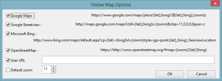
Online Map Options dialog
The Online Map Options dialog is used to select the online maps that can be used to view the GeoPlan. It is also possible to specify a user-defined URL.
The dialog is displayed when the Online Map Options button is clicked in the GeoPlan page of the Options dialog.
| Option | Description | ||||||||||
|---|---|---|---|---|---|---|---|---|---|---|---|
| Online map selection |
Select the desired web mapping services by ticking the check box adjacent to them. These will appear as options when you select View online from the GeoPlan context menu.
|
||||||||||
|
Default zoom |
Zoom in arbitrary units (0 to 20). To specify a zoom level for all web maps, check the adjacent check box and select a value. If this option is not enabled (i.e. unticked checkbox), the online map zoom level will match the GeoPlan current zoom level. |
||||||||||
|
OK |
Commit the changes and close the dialog. |
||||||||||
|
Cancel |
Abort the online map configuration. |

 Tip
Tip 