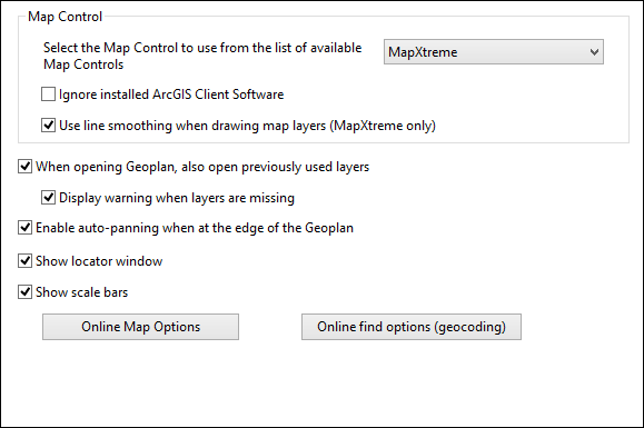
Options dialog - GeoPlan page
This page allows you to set the mapping options.
The page is displayed when you choose Tools | Options and select the GeoPlan tab.
| Item | Description | ||||||
|---|---|---|---|---|---|---|---|
| Map control |
|
||||||
| When opening Geoplan, also open previously used layers | Check this box to automatically open GIS layers previously displayed on the Geoplan being opened. | ||||||
| Display warning when layers are missing | Check this box to have a warning message displayed if any previously used layers are missing. If the box is unchecked, missing layers will be ignored without warning. This option is enabled only when the option to open previously used layers is selected. | ||||||
| Enable auto-panning when at the edge of the Geoplan | Check this box to turn on the automatic panning tool. | ||||||
| Show locator window | Check this box to automatically show the GeoPlan locator map when a GeoPlan is opened. | ||||||
| Show scale bars | Check this box to show scale bars on the GeoPlan, for indicating distances in metres and feet. | ||||||
| Online Map Options | Click this button to open the Online Map Options dialog, on which the availability of web map service options on the GeoPlan context menu is controlled. | ||||||
| Online find options (geocoding) | Click this button to open the Online Find Options (Geocoding) dialog, on which you specify access to web map applications used to find a location. |

