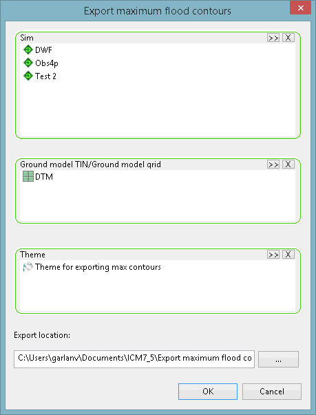
Export Maximum Flood Contours Dialog
This dialog is used to export maximum depth contours from one or more simulations to a selected MapInfo or ESRI file format. It is displayed when an export option is selected from the Results | Export maximum flood contours submenu.
| Option | Description | ||||||||||
|---|---|---|---|---|---|---|---|---|---|---|---|
| Sim |
Select one or more simulations, containing the results to be exported, using one of the following methods:
To clear the selection, click on the |
||||||||||
| Ground model TIN/Ground model grid |
Select a TIN or grid ground model, which provides elevation information, using one of the following methods:

Note
Only a Gridded Ground Model can be used when exporting maximum flood contours using the ESRI ASCII grid files option. To clear the selection, click on the |
||||||||||
| Theme |
Select a theme, which contains contour interval information, using one of the following methods:
To clear the selection, click on the |
||||||||||
| Export location | Specify the folder where the exported files will be saved. Either
type in a path or choose the folder using the  (Browse) button. (Browse) button. |
||||||||||
| OK |
Exports the maximum flood contours. The names of the exported files will be the same as the name(s) of the simulation(s) with the following file extensions:
Note
Existing files in the specified Export location folder, which have the same file names and extensions as the ones currently being exported, will be automatically overwritten during the export operation. |
||||||||||
| Cancels | Cancels the export operation and closes the window. |
 button to search
for a simulation.
button to search
for a simulation. button.