Importing InfoDrainage Data
Data from InfoDrainage models can be imported to InfoWorks ICM using files in the IDDX format.

Only network data from storm phases will be imported; import of foul phase data is not currently supported.
Notional connection types (no delay & lagged flow) are also not supported and will therefore not be imported.
 Tip
TipHydrograph Inflows from InfoDrainage IDDX files can be imported as an Inflow event. See Importing Event Data for further information.
To import InfoDrainage network data:
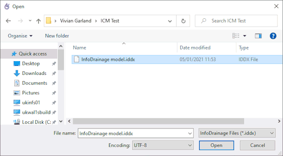
- Open the network to be updated.
- Select Import | Model | from InfoDrainage data from the Network menu, and a standard Windows Open dialog is displayed.
- Select the .iddx file to be imported.
- Click Open.
An import report will be displayed with any import errors or warnings. It will also include the full path of the iddx file which was imported together with the full path in the InfoWorks ICM tree of the target network.

For an iddx file with a single InfoDrainage network, all data is imported into the currently selected scenario of the target network in InfoWorks ICM.
For an iddx file with multiple InfoDrainage networks, the data from each InfoDrainage network is imported into a different scenario in the target network. For example, a InfoDrainage network with name "XXXXX" the corresponding scenario in InfoWorks ICM is named "ID_XXXXX". If a scenario does not already exist, a new one will be created.
For each scenario the report provides the total number of imported objects of different types.
Due to the display precision set on the property fields in InfoWorks ICM, some of the displayed values of the imported InfoDrainage attributes will be truncated. However, the attribute value imported to the master database from InfoDrainage will not be truncated.
For details of the objects imported and any conversions made by the InfoDrainage Importer, see the Import Notes below.
Import Notes
The following sections provide information about the import of network objects from InfoDrainage to InfoWorks ICM:
Junction
Junctions (Manholes and Simple Junctions) in InfoDrainage are imported as Nodes in InfoWorks ICM.
| InfoDrainage Attribute | InfoWorks ICM | Notes | |||||||||
|---|---|---|---|---|---|---|---|---|---|---|---|
| Field | Database name | ||||||||||
| Name | Node ID | node_id | |||||||||
| Junction Type | Node type | node_type |
|
||||||||
| Flood type | flood_type | Set to Stored. | |||||||||
| Width | Base area | base_area |
If InfoDrainage Length = 0, then ICM Base area = 0.25 x Pi x Width x Width If Length > 0, then Base area = Length x Width |
||||||||
| Perimeter | perimeter |
InfoDrainage Length = 0, then ICM Perimeter = Pi x Width If Length > 0, then Perimeter = 2 x (Length + Width) |
|||||||||
| Length | Base area | base_area | See Width. | ||||||||
| Perimeter | perimeter | See Width. | |||||||||
| Diameter | Chamber plan area | chamber_area | If InfoDrainage Width = 0, then Chamber plan area = 0.25 x Pi x Diameter x Diameter; otherwise Chamber plan area = Diameter x Width | ||||||||
| Shaft plan area | shaft_area | If InfoDrainage Width = 0, then Shaft plan area = 0.25 x Pi x Diameter x Diameter; otherwise Shaft plan area = Diameter x Width | |||||||||
| Cover Level | Ground level | ground_level | |||||||||
| Flood level | flood_level | ||||||||||
| Vegetation level | vegetation_level | Imported nodes whose Flood type is set to Storage. | |||||||||
| Invert Level | Chamber floor level | chamber_floor | |||||||||
| Easting | X | x | |||||||||
| Northing | Y | y | |||||||||
Connections
Pipe Connections
An InfoDrainage pipe connection is imported as a Conduit in InfoWorks ICM.
| InfoDrainage Attribute | InfoWorks ICM | Notes | |
|---|---|---|---|
| Field | Database name | ||
| US node ID | us_node_id | Imported from the upstream junction's (junction or manhole) Outgoing Connection. | |
| DS node ID | ds_node_id | Imported from the downstream junction's (junction or manhole) Incoming Connection. | |
| Length | Length | conduit_length | |
| Diameter | Width | conduit_width | |
| Diameter | Height | conduit_height | |
| No. of Barrels | Number of barrels | number_of_barrels | |
| N/A | Roughness type | roughness_type | Set to N if Mannings n is present, set to CW if Colebrook-White is present. |
| Mannings Roughness | Top Roughness Manning's n | top_roughness_n | |
| Bottom Roughness Manning's n | bottom_roughness_n | ||
| Colebrook-White Roughness | Top Roughness Colebrook-White | top_roughness_CW | |
| Bottom Roughness Colebrook-White | bottom_roughness_CW | ||
| Upstream Invert Level | US invert level | us_invert | |
| Downstream Invert Level | DS invert level | ds_invert | |
Box Culvert
An InfoDrainage Box Culvert connection is imported as a Conduit in InfoWorks ICM, with a user-defined cross-section shape. The InfoDrainage Cover Level data from the Box Culvert is imported to a node in ICM. Details of the import are included in the following sections.
Conduit
| InfoDrainage Attribute | InfoWorks ICM | Notes | |
|---|---|---|---|
| Field | Database name | ||
| US node ID | us_node_id | Imported from the upstream junction's (junction or manhole) Outgoing Connection. | |
| DS node ID | ds_node_id | Imported from the downstream junction's (junction or manhole) Incoming Connection. | |
| Link suffix | link_suffix | Set to 1 | |
| Length | Length | conduit_length | |
| Diameter | Width | conduit_width | |
| Diameter | Height | conduit_height | |
| No. of Barrels | Number of barrels | number_of_barrels | |
| N/A | Roughness type | roughness_type | Set to N if Mannings n is present, set to CW if Colebrook-White is present. |
| Mannings Roughness | Top Roughness Manning's n | top_roughness_n | |
| Bottom Roughness Manning's n | bottom_roughness_n | ||
| Colebrook-White Roughness | Top Roughness Colebrook-White | top_roughness_CW | |
| Bottom Roughness Colebrook-White | bottom_roughness_CW | ||
| Upstream Invert Level | US invert level | us_invert | |
| Downstream Invert Level | DS invert level | ds_invert | |
| Shape ID | shape | The naming convention used for the conduit shape is: shape_US node ID.Link suffix. | |
Shape
The cross-section shape of an InfoDrainage Box Culvert is imported as a user-defined shape in ICM.
| InfoDrainage Attribute | InfoWorks ICM | Notes | |||||||||||||
|---|---|---|---|---|---|---|---|---|---|---|---|---|---|---|---|
| Field | Database name | ||||||||||||||
| Shape ID | shape_ID | The naming convention used for the shape is: shape_US node ID.Link suffix. | |||||||||||||
| Shape type | shape_type | Set to Symmetric. | |||||||||||||
| Description | description | The naming convention used for the description is: User-defined shape for conduit US node ID. | |||||||||||||
| Geometry | geometry |
The geometry of the Box Culvert cross-section is imported as follows:
|
|||||||||||||
Node
The InfoDrainage Cover Level data from the Box Culvert is imported to the applicable upstream node in ICM.
| InfoDrainage Attribute | InfoWorks ICM | Notes | |
|---|---|---|---|
| Field | Database name | ||
| Cover Level | Ground level | ground_level | |
| Flood level | flood_level | ||
Rectangular Channel
An InfoDrainage Rectangular Channel connection is imported as a Conduit in InfoWorks ICM with a rectangular type of shape. The following information is also included in the applicable conduit's properties (listed previously) when importing a Rectangular Channel.
| InfoDrainage Attribute | InfoWorks ICM | Notes | |
|---|---|---|---|
| Field | Database name | ||
| Shape ID | shape_ID | Set to RECT (rectangular). | |
Triangular Channel
An InfoDrainage Triangular Channel connection is imported as a Channel in InfoWorks ICM with a triangular channel shape.
| InfoDrainage Attribute | InfoWorks ICM | Notes | |
|---|---|---|---|
| Field | Database name | ||
| US node ID | us_node_id | Imported from the upstream junction's (junction or manhole) Outgoing Connection. | |
| DS node ID | ds_node_id | Imported from the downstream junction's (junction or manhole) Incoming Connection. | |
| Shape ID | shape_ID | Given the same name as the conduits US node ID and the Link Suffix. | |
| Length | Length | length | |
| No. of Barrels | Number of barrels | number_of_barrels | |
| Upstream Invert Level | US invert level | us_invert | |
| Downstream Invert Level | DS invert level | ds_invert | |
Channel Shape
A channel shape is added in ICM when a Triangular Channel connection is imported.
| InfoDrainage Attribute | InfoWorks ICM | Notes | ||||||||||||||||||
|---|---|---|---|---|---|---|---|---|---|---|---|---|---|---|---|---|---|---|---|---|
| Field | Database name | |||||||||||||||||||
| Shape ID | shape_ID | Given the same name as the conduits US node ID and the Link Suffix. | ||||||||||||||||||
| N/A | Roughness Type | roughness_type | Set to N if Mannings n is present, set to CW if Colebrook-White is present. | |||||||||||||||||
| Channel profile | channel_profile |
Up to 5 records per cross-section will be imported.
|
||||||||||||||||||
Trapezoidal Channel
An InfoDrainage Trapezoidal Channel connection is imported as a Channel in InfoWorks ICM with a trapezoidal channel shape.
| InfoDrainage Attribute | InfoWorks ICM | Notes | |
|---|---|---|---|
| Field | Database name | ||
| US node ID | us_node_id | Imported from the upstream junction's (junction or manhole) Outgoing Connection. | |
| DS node ID | ds_node_id | Imported from the downstream junction's (junction or manhole) Incoming Connection. | |
| Shape ID | shape_ID | Given the same name as the conduits US node ID and the Link Suffix. | |
| Length | Length | length | |
| No. of Barrels | Number of barrels | number_of_barrels | |
| Upstream Invert Level | US invert level | us_invert | |
| Downstream Invert Level | DS invert level | ds_invert | |
Channel Shape
A channel shape is added in ICM when a Trapezoidal Channel connection is imported.
| InfoDrainage Attribute | InfoWorks ICM | Notes | |||||||||||||||||||
|---|---|---|---|---|---|---|---|---|---|---|---|---|---|---|---|---|---|---|---|---|---|
| Field | Database name | ||||||||||||||||||||
| Shape ID | shape_ID | Given the same name as the conduits US node ID and the Link Suffix. | |||||||||||||||||||
| N/A | Roughness Type | roughness_type | Set to N if Mannings n is present, set to CW if Colebrook-White is present. | ||||||||||||||||||
| Channel profile | channel_profile |
Only symmetrical trapezoids are generated. Up to 4 records per cross-section are imported; two for the left side and 2 for the right side of the trapezoid.
|
|||||||||||||||||||
Inflows
Catchment Area Inflows
Catchment Area Inflows from InfoDrainage are imported to InfoWorks ICM as Subcatchments and Land use objects.
Subcatchments
| InfoDrainage Attribute | InfoWorks ICM | Notes | |
|---|---|---|---|
| Field | Database name | ||
| Subcatchment ID | subcatchment_id | Given the same name as the Node ID. | |
| System type | system_type | Set to Other. | |
| Area Summary / Connected To | Drains to | drains_to | Set to Node. |
| Node ID | node_id | Set to the name of the node the area inflow is connected to. | |
| Area | Total area | total_area | |
| Contributing area | contributing_area | ||
| X | x | Set to the X coordinate of the node the area inflow is connected to, see Node ID. | |
| Y | y | Set to the X coordinate of the node the area inflow is connected to, see Node ID. | |
| Catchment Area Plan view | Points | boundary_array | |
| Preliminary Sizing / Percentage Imprevious |
Land use ID |
land_use_id |
A new land use object is created for each different Percentage Impervious value imported that is referenced by the relevant subcatchment object(s). The name or ID of the land use object is LandUse_xxx where xxx is the value of the applicable land use object's Default area 1 (%) property. See Land Use for further information. |
| Runoff area 1 absolute | area_absolute_1 | The subcatchment has its Runoff area 1 absolute field set to Percentage Impervious % of its total area and its Runoff area 2 absolute field set to (100 - Percentage Impervious %) of its total area. | |
| Runoff area 1 absolute | area_absolute_2 | ||
Land Use
| InfoDrainage Attribute | InfoWorks ICM | Notes | |
|---|---|---|---|
| Field | Database name | ||
| Preliminary Sizing / Percentage Imprevious |
Land use ID |
land_use_id | The name or ID of the land use object is LandUse_xxx where xxx is the value of the Default area 1 (%) property. |
Hydrograph
Hydograph inflows from InfoDrainage are imported as part of the Subcatchments object data in InfoWorks ICM.
| InfoDrainage Attribute | InfoWorks ICM | Notes | |
|---|---|---|---|
| Field | Database name | ||
|
|
Base flow |
base_flow | Imported if the runoff method is in InfoDrainage is of Unit Hydrograph. |
Outlets
In InfoWorks ICM, an ancillary type of link such as an orifice, will be added for each of the InfoDrainage outlets described in the following sections. Existing pipes will be shortened by 1m (or 10% of its length, if the pipe is less than 10m long) and a new link will be created for each imported ancillary object that is connected to the upstream node. A manhole type of node will be inserted between the ancillary link and the shortened pipe. These manholes will be given the same IDs as the corresponding upstream nodes (US Node ID) but with a "br" suffix, and the Shaft plan area and Chamber plan area fields for the manhole will be set to 1m2.
Orifice
InfoDrainage Orifice types of outlet are imported as Orifice objects in InfoWorks ICM.
| InfoDrainage Attribute | InfoWorks ICM | Notes | |
|---|---|---|---|
| Field | Database name | ||
| US node ID | us_node_id | Imported from the upstream Stormwater Control or Junction's (Junction or Manhole) Outlet Connection. | |
| DS node ID | ds_node_id | New downstream node added with the same name as the US node ID but with a "br" suffix. | |
| Coefficient of Discharge | Discharge coefficient | discharge_coeff | |
| Diameter | Diameter | diameter | |
| Invert Level | Invert level | invert | |
Pump, Harvest Flow, Level Controlled Pump and Siphon
InfoDrainage Pump, Harvest Flow, Level Controlled Pump and Siphon types of outlet are imported as Pump objects and Head discharge objects in InfoWorks ICM.
Pumps
| InfoDrainage Attribute | InfoWorks ICM | Notes | |||||||||
|---|---|---|---|---|---|---|---|---|---|---|---|
| Field | Database name | ||||||||||
| US node ID | us_node_id | Imported from the upstream Stormwater Control or Junction's (Junction or Manhole) Outlet Connection. | |||||||||
| DS node ID | ds_node_id | New downstream node added with the same name as the US node ID but with a "br" suffix. | |||||||||
| N/A | Link type | link_type |
Link type is set to:
|
||||||||
| Invert Level | Switch on level | switch_on_level | For Pumps and Harvest Flows. | ||||||||
| Height | |||||||||||
| Invert Level | Switch off level | switch_off_level | |||||||||
| Cut In Height | Switch on level | switch_on_level | For Level Control Pumps and Siphons. | ||||||||
| Cut Out Height | Switch off level | switch_off_level | |||||||||
| Head discharge ID | head_discharge_id | The ID is set to the US node ID. | |||||||||
| User text 1 | user_text_1 |
Set to OFF for Level Control Pumps. Set to ON for Siphons. |
|||||||||
Head Discharge
| InfoDrainage Attribute | InfoWorks ICM | Notes | ||||||||||
|---|---|---|---|---|---|---|---|---|---|---|---|---|
| Field | Database name | |||||||||||
| Head discharge ID | head_discharge_id | The ID is set to the US node ID for the associated pump. | ||||||||||
| Head discharge power table | HDP_table |
|
||||||||||
Flap Valve
InfoDrainage Flap Valve types of outlet are imported as Flap valve objects in InfoWorks ICM.
| InfoDrainage Attribute | InfoWorks ICM | Notes | |
|---|---|---|---|
| Field | Database name | ||
| US node ID | us_node_id | Imported from the upstream Stormwater Control or Junction's (Junction or Manhole) Outlet Connection. | |
| DS node ID | ds_node_id | New downstream node added with the same name as the US node ID but with a "br" suffix. | |
| Coefficient of Discharge | Discharge coefficient | discharge_coeff | |
| Diameter | Diameter | diameter | |
| Invert Level | Invert level | invert | |
Gate
InfoDrainage Gate types of outlet are imported as Sluice objects in InfoWorks ICM, with their Link type set to VNWEIR.
| InfoDrainage Attribute | InfoWorks ICM | Notes | |
|---|---|---|---|
| Field | Database name | ||
| US node ID | us_node_id | Imported from the upstream Stormwater Control or Junction's (Junction or Manhole) Outlet Connection. | |
| DS node ID | ds_node_id | New downstream node added with the same name as the US node ID but with a "br" suffix. | |
| N/A | Link suffix | link_suffix | Set to 1 |
| Height | Opening | opening | |
| Width | Width | width |
|
| Invert Level | Invert | invert | |
| Coefficient of Contraction | Discharge coefficient | discharge_coeff | |
Weir
InfoDrainage Weir types of outlet are imported as Weir objects in InfoWorks ICM, with their Link type set to WEIR.
| InfoDrainage Attribute | InfoWorks ICM | Notes | |
|---|---|---|---|
| Field | Database name | ||
| US node ID | us_node_id | Imported from the upstream Stormwater Control or Junction's (Junction or Manhole) Outlet Connection. | |
| DS node ID | ds_node_id | New downstream node added with the same name as the US node ID but with a "br" suffix. | |
| N/A | Link type | link_type | Link type is set to WEIR in InfoWorks ICM. |
| Coefficient of Discharge | Discharge coefficient | discharge_coeff | |
| Crest Level | Crest | crest | |
| Width | Width | width | |
V-Notch Weir
InfoDrainage v-notch weir types of outlet are imported as Weir objects in InfoWorks ICM, with their Link type set to VNWEIR.
| InfoDrainage Attribute | InfoWorks ICM | Notes | |
|---|---|---|---|
| Field | Database name | ||
| US node ID | us_node_id | Imported from the upstream Stormwater Control or Junction's (Junction or Manhole) Outlet Connection. | |
| DS node ID | ds_node_id | New downstream node added with the same name as the US node ID but with a "br" suffix. | |
| N/A | Link type | link_type | Link type is set to VNWEIR in InfoWorks ICM. |
| Invert Level | Crest | crest | |
| Width | Width | width |
Calculated as: 2 x Height x tan(0.5 x Angle); where Angle is in radians. |
| Height | Notch height | notch_height | |
| Angle | Notch angle | notch_angle | |
| N/A | Number of notches | number_of_notches | Set to 1 |
Multiple
InfoDrainage Multiple outlets are imported as the relevant ancillary type of link, such as an orifice, in InfoWorks ICM.
For each Multiple outlet in InfoDrainage, the following information will be imported as a link in ICM.
| InfoDrainage Attribute | InfoWorks ICM | Notes | |
|---|---|---|---|
| Field | Database name | ||
| US node ID | us_node_id | Imported from the upstream Stormwater Control or Junction's (Junction or Manhole) Outlet Connection. | |
| Control List | Link type | link_type | Link type in InfoWorks ICM is set to the relevant type of outlet from the list of controls in InfoDrainage. |
See the previous sections for details of the data imported for each type of outlet control.
Depth Flow, Hydo-Brake and Filtration
An InfoDrainage Depth Flow, Hydo-Brake and Filtration outlets are imported as a User-defined Control object and a Head Discharge object in InfoWorks ICM.
User-defined control
| InfoDrainage Attribute | InfoWorks ICM | Notes | |
|---|---|---|---|
| Field | Database name | ||
| US node ID | us_node_id | Imported from the upstream Stormwater Control or Junction's (Junction or Manhole) Outlet Connection. | |
| DS node ID | ds_node_id | New downstream node added with the same name as the US node ID but with a "br" suffix. | |
| Invert Level | Initial level | initial_level | |
| Head discharge ID | head_discharge_id | The name of the relevant Depth Flow, Hydo-Brake and Filtration outlet. | |
Head Discharge
| InfoDrainage Attribute | InfoWorks ICM | Notes | |||||||||||||||||||||||||||||||||||||||||
|---|---|---|---|---|---|---|---|---|---|---|---|---|---|---|---|---|---|---|---|---|---|---|---|---|---|---|---|---|---|---|---|---|---|---|---|---|---|---|---|---|---|---|---|
| Field | Database name | ||||||||||||||||||||||||||||||||||||||||||
| Head discharge ID | head_discharge_id | The name of the relevant Depth Flow, Hydo-Brake and Filtration outlet. | |||||||||||||||||||||||||||||||||||||||||
| Head discharge power table | HDP_table |
Depth Flow and Hydo-Brake For Depth Flow and Hydo-Brake outlets, a record is added to the table for each Depth/Outflow:
Filtration For a Filtration outlet, 2 records are added to the storage array:
|
|||||||||||||||||||||||||||||||||||||||||
Storm Water Controls (SWC)
Swales
A Swale type of Storm Water Control from InfoDrainage is imported as a node in InfoWorks ICM.
| InfoDrainage Attribute | InfoWorks ICM | Notes | |||||||||||||||||||||||||||||||||||||||||||||||||||||||||||||||||||||||||||||||||||||||||||||||||||||||||||||||||||||||||||||||||||||||||||||||||||||||||||||||||||||||||||||||||||||||
|---|---|---|---|---|---|---|---|---|---|---|---|---|---|---|---|---|---|---|---|---|---|---|---|---|---|---|---|---|---|---|---|---|---|---|---|---|---|---|---|---|---|---|---|---|---|---|---|---|---|---|---|---|---|---|---|---|---|---|---|---|---|---|---|---|---|---|---|---|---|---|---|---|---|---|---|---|---|---|---|---|---|---|---|---|---|---|---|---|---|---|---|---|---|---|---|---|---|---|---|---|---|---|---|---|---|---|---|---|---|---|---|---|---|---|---|---|---|---|---|---|---|---|---|---|---|---|---|---|---|---|---|---|---|---|---|---|---|---|---|---|---|---|---|---|---|---|---|---|---|---|---|---|---|---|---|---|---|---|---|---|---|---|---|---|---|---|---|---|---|---|---|---|---|---|---|---|---|---|---|---|---|---|---|---|---|
| Field | Database name | ||||||||||||||||||||||||||||||||||||||||||||||||||||||||||||||||||||||||||||||||||||||||||||||||||||||||||||||||||||||||||||||||||||||||||||||||||||||||||||||||||||||||||||||||||||||||
| Name | Node ID | node_id | Name of the Swale. | ||||||||||||||||||||||||||||||||||||||||||||||||||||||||||||||||||||||||||||||||||||||||||||||||||||||||||||||||||||||||||||||||||||||||||||||||||||||||||||||||||||||||||||||||||||||
| Node type | node_type | ||||||||||||||||||||||||||||||||||||||||||||||||||||||||||||||||||||||||||||||||||||||||||||||||||||||||||||||||||||||||||||||||||||||||||||||||||||||||||||||||||||||||||||||||||||||||
| X | x | ||||||||||||||||||||||||||||||||||||||||||||||||||||||||||||||||||||||||||||||||||||||||||||||||||||||||||||||||||||||||||||||||||||||||||||||||||||||||||||||||||||||||||||||||||||||||
| Y | y | ||||||||||||||||||||||||||||||||||||||||||||||||||||||||||||||||||||||||||||||||||||||||||||||||||||||||||||||||||||||||||||||||||||||||||||||||||||||||||||||||||||||||||||||||||||||||
| Base Infiltration Rate / Safety Factor | Infiltration loss coefficient | infiltration_coeff | |||||||||||||||||||||||||||||||||||||||||||||||||||||||||||||||||||||||||||||||||||||||||||||||||||||||||||||||||||||||||||||||||||||||||||||||||||||||||||||||||||||||||||||||||||||||
| Base Infiltration Rate / Safety Factor | Infiltration loss coefficient below liner |
infiltratn_coeff_blw_liner |
|||||||||||||||||||||||||||||||||||||||||||||||||||||||||||||||||||||||||||||||||||||||||||||||||||||||||||||||||||||||||||||||||||||||||||||||||||||||||||||||||||||||||||||||||||||||
| Side Infiltration Rate / SafetyFactor | Infiltration loss coefficient above liner | infiltratn_coeff_abv_liner | |||||||||||||||||||||||||||||||||||||||||||||||||||||||||||||||||||||||||||||||||||||||||||||||||||||||||||||||||||||||||||||||||||||||||||||||||||||||||||||||||||||||||||||||||||||||
| Exceedence Level (m) | Ground level | ground_level | |||||||||||||||||||||||||||||||||||||||||||||||||||||||||||||||||||||||||||||||||||||||||||||||||||||||||||||||||||||||||||||||||||||||||||||||||||||||||||||||||||||||||||||||||||||||
| Flood level | flood_level | ||||||||||||||||||||||||||||||||||||||||||||||||||||||||||||||||||||||||||||||||||||||||||||||||||||||||||||||||||||||||||||||||||||||||||||||||||||||||||||||||||||||||||||||||||||||||
| Vegetation level | vegetation_level | ||||||||||||||||||||||||||||||||||||||||||||||||||||||||||||||||||||||||||||||||||||||||||||||||||||||||||||||||||||||||||||||||||||||||||||||||||||||||||||||||||||||||||||||||||||||||
| Base Level | Liner level | liner_level | |||||||||||||||||||||||||||||||||||||||||||||||||||||||||||||||||||||||||||||||||||||||||||||||||||||||||||||||||||||||||||||||||||||||||||||||||||||||||||||||||||||||||||||||||||||||
| Storage array |
storage_array |
Swale without a Trench If the Swale does not include a Trench, the storage array contains two records:
Swale with a Trench If the Swale includes a Trench but no under drain pipe, the storage array will contain at least four records described below.
Swale with a Trench and Under Drain If the Swale includes a Trench and an underdrain pipe, ie, the Under Drain On box is checked in InfoDrainage, an additional record will be added to the storage array for every 1/10th of the pipe diameter to represent the pipe.
|
|||||||||||||||||||||||||||||||||||||||||||||||||||||||||||||||||||||||||||||||||||||||||||||||||||||||||||||||||||||||||||||||||||||||||||||||||||||||||||||||||||||||||||||||||||||||

Porous Pavement
A Porous Pavement type of Storm Water Control from InfoDrainage is imported as a node object in InfoWorks ICM.
| InfoDrainage Attribute | InfoWorks ICM | Notes | |||||||||||||||||||||||||||||||||||||||||||||||||||||||||||||||
|---|---|---|---|---|---|---|---|---|---|---|---|---|---|---|---|---|---|---|---|---|---|---|---|---|---|---|---|---|---|---|---|---|---|---|---|---|---|---|---|---|---|---|---|---|---|---|---|---|---|---|---|---|---|---|---|---|---|---|---|---|---|---|---|---|---|
| Field | Database name | ||||||||||||||||||||||||||||||||||||||||||||||||||||||||||||||||
| Name | Node ID | node_id | The name of the Porous Pavement. | ||||||||||||||||||||||||||||||||||||||||||||||||||||||||||||||
| Node type | node_type | Set to Pond. | |||||||||||||||||||||||||||||||||||||||||||||||||||||||||||||||
| X | x | ||||||||||||||||||||||||||||||||||||||||||||||||||||||||||||||||
| Y | y | ||||||||||||||||||||||||||||||||||||||||||||||||||||||||||||||||
| Base Infiltration Rate / Safety Factor | Infiltration loss coefficient | infiltration_coeff | |||||||||||||||||||||||||||||||||||||||||||||||||||||||||||||||
| Base Infiltration Rate / Safety Factor | Infiltration loss coefficient below liner |
infiltratn_coeff_blw_liner |
|||||||||||||||||||||||||||||||||||||||||||||||||||||||||||||||
| Side Infiltration Rate / SafetyFactor | Infiltration loss coefficient above liner | infiltratn_coeff_abv_liner | |||||||||||||||||||||||||||||||||||||||||||||||||||||||||||||||
| Cover Level (m) | Ground level | ground_level | |||||||||||||||||||||||||||||||||||||||||||||||||||||||||||||||
| Flood level | flood_level | ||||||||||||||||||||||||||||||||||||||||||||||||||||||||||||||||
| Vegetation level | vegetation_level | ||||||||||||||||||||||||||||||||||||||||||||||||||||||||||||||||
|
Invert Level |
Liner level |
liner_level |
|||||||||||||||||||||||||||||||||||||||||||||||||||||||||||||||
| Storage array |
storage_array |
Four records are added to the storage array:
The area for the Paving Layer Depth will be 0.001 if the Paving Layer Depth is greater than 0 |
|||||||||||||||||||||||||||||||||||||||||||||||||||||||||||||||
Infiltration Trench
An Infiltration Trench type of Storm Water Control from InfoDrainage is imported as a node object in InfoWorks ICM.
| InfoDrainage Attribute | InfoWorks ICM | Notes | ||||||||||||||||||||||||||||||||||
|---|---|---|---|---|---|---|---|---|---|---|---|---|---|---|---|---|---|---|---|---|---|---|---|---|---|---|---|---|---|---|---|---|---|---|---|---|
| Field | Database name | |||||||||||||||||||||||||||||||||||
| Name | Node ID | node_id | The name of the Infiltration Trench. | |||||||||||||||||||||||||||||||||
| Node type | node_type | Set to Pond. | ||||||||||||||||||||||||||||||||||
| X | x | |||||||||||||||||||||||||||||||||||
| Y | y | |||||||||||||||||||||||||||||||||||
| Base Infiltration Rate / Safety Factor | Infiltration loss coefficient | infiltration_coeff | ||||||||||||||||||||||||||||||||||
| Base Infiltration Rate / Safety Factor | Infiltration loss coefficient below liner |
infiltratn_coeff_blw_liner |
||||||||||||||||||||||||||||||||||
| Side Infiltration Rate / SafetyFactor | Infiltration loss coefficient above liner | infiltratn_coeff_abv_liner | ||||||||||||||||||||||||||||||||||
| Cover Level (m) | Ground level | ground_level | ||||||||||||||||||||||||||||||||||
| Flood level | flood_level | |||||||||||||||||||||||||||||||||||
| Vegetation level | vegetation_level | |||||||||||||||||||||||||||||||||||
|
Invert Level |
Liner level |
liner_level |
||||||||||||||||||||||||||||||||||
| Storage array | storage_array |
Two records are added to the storage array:
|
||||||||||||||||||||||||||||||||||
Bioretention
A Bioretention type of Storm Water Control from InfoDrainage is imported as a node object in InfoWorks ICM.
| InfoDrainage Attribute | InfoWorks ICM | Notes | |||||||||||||||||||||||||||||||||||||||||||||||||||||||||
|---|---|---|---|---|---|---|---|---|---|---|---|---|---|---|---|---|---|---|---|---|---|---|---|---|---|---|---|---|---|---|---|---|---|---|---|---|---|---|---|---|---|---|---|---|---|---|---|---|---|---|---|---|---|---|---|---|---|---|---|
| Field | Database name | ||||||||||||||||||||||||||||||||||||||||||||||||||||||||||
| Name | Node ID | node_id | The name of the Bioretention control. | ||||||||||||||||||||||||||||||||||||||||||||||||||||||||
| Node type | node_type | Set to Pond. | |||||||||||||||||||||||||||||||||||||||||||||||||||||||||
| X | x | ||||||||||||||||||||||||||||||||||||||||||||||||||||||||||
| Y | y | ||||||||||||||||||||||||||||||||||||||||||||||||||||||||||
|
Base Infiltration Rate / Safety Factor |
Infiltration loss coefficient |
infiltration_coeff |
From the Bioretention 's Filter Area. | ||||||||||||||||||||||||||||||||||||||||||||||||||||||||
| Base Infiltration Rate / Safety Factor | Infiltration loss coefficient below liner | infiltratn_coeff_blw_liner | |||||||||||||||||||||||||||||||||||||||||||||||||||||||||
| Side Infiltration Rate / SafetyFactor | Infiltration loss coefficient above liner | infiltratn_coeff_abv_liner | |||||||||||||||||||||||||||||||||||||||||||||||||||||||||
| Cover Level (m) | Ground level | ground_level | From the Bioretention 's Ponding Area. | ||||||||||||||||||||||||||||||||||||||||||||||||||||||||
| Flood level | flood_level | ||||||||||||||||||||||||||||||||||||||||||||||||||||||||||
| Vegetation level | vegetation_level | ||||||||||||||||||||||||||||||||||||||||||||||||||||||||||
|
Invert Level |
Liner level |
liner_level |
|||||||||||||||||||||||||||||||||||||||||||||||||||||||||
| Storage array |
Storage_array |
One record is added to the storage array for each filtration layer in a Bioretention control as follows:
|
|||||||||||||||||||||||||||||||||||||||||||||||||||||||||
Soakaway
A Soakaway type of Storm Water Controls from InfoDrainage is imported as a node object in InfoWorks ICM.
| InfoDrainage Attribute | InfoWorks ICM | Notes | ||||||||||||||||||||||||||||||||||||||||||||||||||||||||||||||||||||||||||||||||||
|---|---|---|---|---|---|---|---|---|---|---|---|---|---|---|---|---|---|---|---|---|---|---|---|---|---|---|---|---|---|---|---|---|---|---|---|---|---|---|---|---|---|---|---|---|---|---|---|---|---|---|---|---|---|---|---|---|---|---|---|---|---|---|---|---|---|---|---|---|---|---|---|---|---|---|---|---|---|---|---|---|---|---|---|---|
| Field | Database name | |||||||||||||||||||||||||||||||||||||||||||||||||||||||||||||||||||||||||||||||||||
| Name | Node ID | node_id | The name of the Soakaway. | |||||||||||||||||||||||||||||||||||||||||||||||||||||||||||||||||||||||||||||||||
| Node type | node_type | Set to Pond. | ||||||||||||||||||||||||||||||||||||||||||||||||||||||||||||||||||||||||||||||||||
| X | x | |||||||||||||||||||||||||||||||||||||||||||||||||||||||||||||||||||||||||||||||||||
| Y | y | |||||||||||||||||||||||||||||||||||||||||||||||||||||||||||||||||||||||||||||||||||
| Base Infiltration Rate / Safety Factor | Infiltration loss coefficient | infiltration_coeff | ||||||||||||||||||||||||||||||||||||||||||||||||||||||||||||||||||||||||||||||||||
| Base Infiltration Rate / Safety Factor | Infiltration loss coefficient below liner |
infiltratn_coeff_blw_liner |
||||||||||||||||||||||||||||||||||||||||||||||||||||||||||||||||||||||||||||||||||
| Side Infiltration Rate / SafetyFactor | Infiltration loss coefficient above liner | infiltratn_coeff_abv_liner | ||||||||||||||||||||||||||||||||||||||||||||||||||||||||||||||||||||||||||||||||||
| Cover Level (m) | Ground level | ground_level | ||||||||||||||||||||||||||||||||||||||||||||||||||||||||||||||||||||||||||||||||||
| Flood level | flood_level | |||||||||||||||||||||||||||||||||||||||||||||||||||||||||||||||||||||||||||||||||||
| Vegetation level | vegetation_level | |||||||||||||||||||||||||||||||||||||||||||||||||||||||||||||||||||||||||||||||||||
|
Invert Level |
Liner level | liner_level | ||||||||||||||||||||||||||||||||||||||||||||||||||||||||||||||||||||||||||||||||||
| Storage array | storage_array |
Two records will be added to the storage array for each type of Soakaway Shape as follows: Rectangular
Square
Circular
Note that the InfoDrainage Ineffective Storage Depth attribute is not imported. |
||||||||||||||||||||||||||||||||||||||||||||||||||||||||||||||||||||||||||||||||||
Pond
A Pond type of Storm Water Control from InfoDrainage is imported as a node object in InfoWorks ICM.
| InfoDrainage Attribute | InfoWorks ICM | Notes | ||||||||||||||||||||||||||||
|---|---|---|---|---|---|---|---|---|---|---|---|---|---|---|---|---|---|---|---|---|---|---|---|---|---|---|---|---|---|---|
| Field | Database name | |||||||||||||||||||||||||||||
| Name | Node ID | node_id | The name of the Pond. | |||||||||||||||||||||||||||
| Node type | node_type | Set to Pond. | ||||||||||||||||||||||||||||
| X | x | |||||||||||||||||||||||||||||
| Y | y | |||||||||||||||||||||||||||||
| Base Infiltration Rate / Safety Factor | Infiltration loss coefficient | infiltration_coeff | ||||||||||||||||||||||||||||
| Base Infiltration Rate / Safety Factor | Infiltration loss coefficient below liner |
infiltratn_coeff_blw_liner |
||||||||||||||||||||||||||||
| Side Infiltration Rate / SafetyFactor | Infiltration loss coefficient above liner | infiltratn_coeff_abv_liner | ||||||||||||||||||||||||||||
| Cover Level (m) | Ground level | ground_level | ||||||||||||||||||||||||||||
| Flood level | flood_level | |||||||||||||||||||||||||||||
| Vegetation level | vegetation_level | |||||||||||||||||||||||||||||
|
Invert Level |
Liner level | liner_level | ||||||||||||||||||||||||||||
| Storage array | storage_array |
The 'shape' of the pond (Circular or Square) is determined from the setting in the InfoDrainage Pond's Perimeter attribute. At least two records will be added to the storage array for each type of pond shape as follows:
If the final record's level is not equal to the ground level, another record with a level equal to the ground level and with an Area and Perimeter the same as the previous record, will be generated. |
||||||||||||||||||||||||||||
Tank
A Tank type of Storm Water Control from InfoDrainage is imported as a node object in InfoWorks ICM.
| InfoDrainage Attribute | InfoWorks ICM | Notes | ||||||||||||||||||||||||||||
|---|---|---|---|---|---|---|---|---|---|---|---|---|---|---|---|---|---|---|---|---|---|---|---|---|---|---|---|---|---|---|
| Field | Database name | |||||||||||||||||||||||||||||
| Name | Node ID | node_id | The name of the Pond. | |||||||||||||||||||||||||||
| Node type | node_type | Set to Storage. | ||||||||||||||||||||||||||||
| X | x | |||||||||||||||||||||||||||||
| Y | y | |||||||||||||||||||||||||||||
| Base Infiltration Rate / Safety Factor | Infiltration loss coefficient | infiltration_coeff | ||||||||||||||||||||||||||||
| Base Infiltration Rate / Safety Factor | Infiltration loss coefficient below liner |
infiltratn_coeff_blw_liner |
||||||||||||||||||||||||||||
| Side Infiltration Rate / SafetyFactor | Infiltration loss coefficient above liner | infiltratn_coeff_abv_liner | ||||||||||||||||||||||||||||
| Cover Level (m) | Ground level | ground_level | ||||||||||||||||||||||||||||
| Flood level | flood_level | |||||||||||||||||||||||||||||
| Vegetation level | vegetation_level | |||||||||||||||||||||||||||||
|
Invert Level |
Liner level | liner_level | ||||||||||||||||||||||||||||
| Storage array | storage_array |
The 'shape' of the tank (Circular or Square) is determined from the setting in the InfoDrainage Tank's Perimeter attribute. At least two records will be added to the storage array for each type of tank shape as follows:
If the final record's level is not equal to the ground level, another record with a level equal to the ground level and with an Area and Perimeter the same as the previous record, will be generated. |
||||||||||||||||||||||||||||
| Base area | base_area | Set to the same Area as the final record in the Storage array. | ||||||||||||||||||||||||||||
| Perimeter | perimeter | Set to the same Perimeter as the final record in the Storage array. | ||||||||||||||||||||||||||||
| Porosity | Porosity | porosity | ||||||||||||||||||||||||||||
Chamber
A Chamber type of Storm Water Control from InfoDrainage is imported as a node object in InfoWorks ICM.
| InfoDrainage Attribute | InfoWorks ICM | Notes | |
|---|---|---|---|
| Field | Database name | ||
| Name | Node ID | node_id | The name of the Chamber control. |
| Node type | node_type | Set to Pond. | |
| X | x | ||
| Y | y | ||
|
Base Infiltration Rate / Safety Factor |
Infiltration loss coefficient |
infiltration_coeff |
|
| Base Infiltration Rate / Safety Factor | Infiltration loss coefficient below liner | infiltratn_coeff_blw_liner | |
| Side Infiltration Rate / SafetyFactor | Infiltration loss coefficient above liner | infiltratn_coeff_abv_liner | |
| Cover Level (m) | Ground level | ground_level | |
| Flood level | flood_level | ||
| Vegetation level | vegetation_level | ||
|
Invert Level |
Liner level | liner_level | |
| Storage array |
Storage_array |
Storage array data will be imported for each type of chamber, with the first record at the chamber's Base Level and the final record at the Chamber's Exceedence Level. |
|
Cellular Storage
A Cellular Storage type of Storm Water Control from InfoDrainage is imported as a node object in InfoWorks ICM.
| InfoDrainage Attribute | InfoWorks ICM | Notes | ||||||||||||||||||||||||||||||||||||||||||||||||||||||||||||||||||||||||||||||||||||
|---|---|---|---|---|---|---|---|---|---|---|---|---|---|---|---|---|---|---|---|---|---|---|---|---|---|---|---|---|---|---|---|---|---|---|---|---|---|---|---|---|---|---|---|---|---|---|---|---|---|---|---|---|---|---|---|---|---|---|---|---|---|---|---|---|---|---|---|---|---|---|---|---|---|---|---|---|---|---|---|---|---|---|---|---|---|---|
| Field | Database name | |||||||||||||||||||||||||||||||||||||||||||||||||||||||||||||||||||||||||||||||||||||
| Name | Node ID | node_id | The name of the Cellular Storage control. | |||||||||||||||||||||||||||||||||||||||||||||||||||||||||||||||||||||||||||||||||||
| Node type | node_type | Set to Pond. | ||||||||||||||||||||||||||||||||||||||||||||||||||||||||||||||||||||||||||||||||||||
| X | x | |||||||||||||||||||||||||||||||||||||||||||||||||||||||||||||||||||||||||||||||||||||
| Y | y | |||||||||||||||||||||||||||||||||||||||||||||||||||||||||||||||||||||||||||||||||||||
| Base Infiltration Rate / Safety Factor | Infiltration loss coefficient | infiltration_coeff | ||||||||||||||||||||||||||||||||||||||||||||||||||||||||||||||||||||||||||||||||||||
| Base Infiltration Rate / Safety Factor | Infiltration loss coefficient below liner |
infiltratn_coeff_blw_liner |
||||||||||||||||||||||||||||||||||||||||||||||||||||||||||||||||||||||||||||||||||||
| Side Infiltration Rate / SafetyFactor | Infiltration loss coefficient above liner | infiltratn_coeff_abv_liner | ||||||||||||||||||||||||||||||||||||||||||||||||||||||||||||||||||||||||||||||||||||
| Exceedence Level (m) | Ground level | ground_level | ||||||||||||||||||||||||||||||||||||||||||||||||||||||||||||||||||||||||||||||||||||
| Flood level | flood_level | |||||||||||||||||||||||||||||||||||||||||||||||||||||||||||||||||||||||||||||||||||||
| Vegetation level | vegetation_level | . | ||||||||||||||||||||||||||||||||||||||||||||||||||||||||||||||||||||||||||||||||||||
|
Base Level |
Liner level |
liner_level |
||||||||||||||||||||||||||||||||||||||||||||||||||||||||||||||||||||||||||||||||||||
| Storage array | storage_array |
Records will be added to the storage array for each Cellular Storage control, which contains crates, as follows:
Note that if the Base Level plus total height is equal to the Exceedance Level, only two records - the first (Base Level) and last (Exceedence Level) - will be added to the storage array. |
||||||||||||||||||||||||||||||||||||||||||||||||||||||||||||||||||||||||||||||||||||
