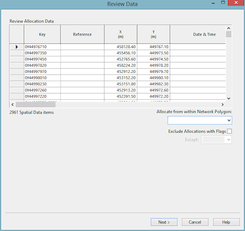
Spatial Data Analysis Wizard - Review Page
The review page allows you to view the points that will be used for allocation in future steps, and make changes to the data if required. If there is a large amount of data you may see a progress bar entitled Scanning Acquired Spatial Data Items.
You can edit any of the fields. For instance you may want to fill in data for fields that were not included in the imported data.
Limiting Allocation
On this page you can choose to limit the spatial data points used for allocation, by setting a bounding polygon.
It is also possible to limit the spatial data points that are included by setting a flag. Only spatial data points which have this flag for their Allocated Pipe ID field will be included in the allocation. The flags can be viewed on the Spatial Data Grid.
Each time the options limiting the points used are changed, a progress bar titled Scanning Spatial Data Items may appear as InfoWorks rebuilds the list of included data points.
Finally
Click Next to continue. If you have chosen to re-allocate existing points, you may see a progress bar entitled Clearing Previous Allocations.
The Pre-Allocate Page of the wizard is displayed.
