What's New in Version 11.5 - February 2011
This topic lists all the additions and improvements incorporated in
Inventory Management and Task Approval Processing
InfoNetcan now keep a track of materials "consumed" by scheduled tasks. Inventory information can now be stored within InfoNet and inventory items (and their associated costs) can be allocated to scheduled tasks, hence to the related network assets.
Three new resourcing objects (Material, Approval Level and Order) have been introduced (Please refer to Resourcing Objects for more details):
- Materials are equipment or components to be used to perform the task. They are different from Resources, which are existing objects representing contractors or teams carrying out the work.
- Approval Levels are objects allowing users to identify cost levels requiring authorisation (for example, if the estimated cost to carry out a task exceeds a certain threshold). Approval Level objects are more likely to be implemented in conjunction with InfoAsset Mobile InfoAsset Mobile is an Innovyze application intended for use with InfoAsset Manager, to ease the collection of asset data in the field and to facilitate the seamless transfer to an InfoAsset Manager database..
- Order objects relate to the materials used to perform the task and are mainly useful in the context of the inventory report.
The inventory report is a new report that, when generated, contains inventory details for all the materials in the network (or a selection of materials) and highlights to the user whenever materials need re-ordering or if there is anticipation of a supply problem.
Scheduled task property sheets have been enhanced with two new fields (Approval level and Approval status) to enable implementation of the task approval functionality. InfoNet can be configured to automatically manage approval levels and statuses via the Manage approval status option from the Custom Scheduling dialog. Tasks for which the estimated cost is greater than the corresponding approval level need to be processed by approving officers via the Approve Scheduled Tasks dialog. Please refer to the Approving, rejecting or putting Scheduled Tasks on hold topic for further information.
Active tasks, as well as completed tasks can now be updated. As a result, the Custom Scheduling dialog has been enhanced with additional settings relating to actions to perform whenever active tasks are being updated. For added security, the custom scheduling dialog has been permissioned. Settings can only be edited by Database owners if permissions are implemented.
New reporting functionality - Dashboards
Dashboard is a new object type available to all types of network. Dashboards are composed of graphical components called widgets used to display a high level overview based on the results of stored queries that can be run on the same network or across different networks of the same type.
Dashboards can be opened in two different modes : a design view, where SQL queries and networks are specified and widgets are configured, and a normal or operational view where widget results are displayed. Dashboards can be saved in workspaces so that users can specify a specific dashboard to open at startup.
See Dashboard topic for further information.
New Vortex Object for Collection Networks
Vortex is a new type of ancillary available for Collection networks. Vortices are represented by a link in the application and can be found in the Asset Grid.
See Vortex and Vortex Data Fields for further details.
New Phase field for Scheduled Tasks
A new Phase field has been added to all Scheduled Task objects. The field is intended for use with multi-step work orders to identify which stage of the task has been reached.
The Phase field is customisable as a User Defined Choice List for each schedule object type. Tasks can also be filtered on Phase in the Scheduled Task Filter Dialog.
New Valve fields
New Height, Shape and Material fields have been added to Collection Network valve objects.
See Valve (Collection) Data Fields for details.
Ability to batch import CCTV files
It is now possible to select multiple files for import when importing CCTV data from the following formats:
- MSCC XML
- BEFDSS XML
- SUFRIB SUF
See Importing CCTV Survey Data for further information.
Improvements to CCTV Survey Exporters
There is now a submenu under the Network | Export | Export survey data menu containing options for exporting CCTV data to each of the formats supported by InfoNet.
The export dialog displayed will contain the options specific to the chosen export format.
(In previous versions of the application, export of survey data to a number of formats was selected from a single dialog.)
See Exporting Survey Data for further information.
Pipeline View Report
The new Pipeline View Report contains records for selected CCTV surveys, displaying a diagram of the pipe labelled with survey defects and comments. To generate the report, select the Survey reports | CCTV pipeline view report option from the Reports menu.
See InfoAsset Manager Reports for further information on generating reports.
CCTV Survey Report in PACP format
It is now possible to generate CCTV Survey report records in PACP format. To generate the report, select the Survey reports | CCTV survey report (PACP format)... option from the Reports menu.
See InfoAsset Manager Reports for further information on generating reports.
New image creation options
Resolution and zoom/scale settings, for use when creating location sketch images for selected network objects, have been added to the GeoPlan page of the Options Dialog.
These settings will also be applied when generating location sketches for reports.
Improvements to Custom Scheduling
A warning log is now displayed in conjunction with the Custom Scheduling dialog whenever one or more queries that have been custom scheduled have in the meantime been deleted or renamed in the tree view. The log informs the user that custom scheduling has been changed outside of the dialog and lists the deleted or renamed queries. When the associated task creation or update is invoked, deleted queries are not run whereas renamed queries are run. Users can get rid of the warning log by clicking on OK on the Custom Scheduling dialog.
Please note that custom scheduling has changed in that users can now also specify queries to run when updating active tasks. See Custom Scheduling for further information.
Improvements to Create Scheduled Tasks Dialog
General maintenance and collection network monitoring survey tasks can be associated with either nodes or pipes. In previous versions of InfoNet, when using the Create a new task for each selected item option on the Create Scheduled Tasks Dialog, tasks would only be created for one selected asset type (nodes for general maintenance, pipes for monitoring surveys).
In this version, the scheduled tasks dialog supports the creation of general maintenance and monitoring survey tasks for pipes and nodes simultaneously (if both are selected).
In addition the options set when using the Create Scheduled Tasks Dialog are now remembered for the next time the dialog is opened. (Previously, the dialog was always opened with default settings.)
See Scheduled Tasks for further information.
Enhancement to import of Access Database data
Queries are now available for selection in the Feature dropdown list of the Open Data Import Centre dialog, as well as tables, when data is imported from Access Databases.
Please refer to the Open Data Import Centre dialog topic for more information.
Improvements to GeoPlan network object deletion functionality
The process of deleting network object in the GeoPlan has been enhanced for security reasons. Tighter control over the type of user notification has been implemented to offer greater flexibility and to help prevent accidental deletions. The user can now choose between immediate deletion without notification, display of a progress dialog for a minimum of 1.5 s and deletion with automatic confirmation. Moreover, database owners can override any of these settings by forcing all database users to confirm object deletion. User notification options can be configured in the General Page of the Options dialog.
See Deleting Network Objects and Options dialog - General Page topics for further details.
SQL Enhancements
Several SQL enhancements have been made for this version of InfoNet. See the SQL technical note for further details.
- A new ORDER BY clause has been added, which is used to sort the records output to grids and csv files when using explicit SELECT clauses. Records can be sorted in ascending or descending order by use of the keywords ASC and DESC. Number of records output can be restricted by use of the keywords TOP and BOTTOM.
- The keyword DISTINCT can be used in an explicit SELECT clause to return a group of values without duplicates. It can be used in conjunction with WHERE and ORDER BY
- A new INSERT clause has been added, which allows objects to be inserted into the network or rows to be inserted into arrays.
For example:
SELECT DISTINCT width,ds_width WHERE pipe_material = 'co' ORDER BY width ASC, ds_width ASC
will display in a grid view one record for each distinct set of width and downstream width values for all concrete pipes, sorted in ascending order by width and then by downstream width.
For example:
INSERT INTO node (node_id,x,y) VALUES ('N1', 123, 456)
will add a node 'N1' to the network with X coordinate 123 and Y coordinate 456.
New SQL functions
New SQL date functions have been added:
- MONTHYEARPART returns the month and year of a date as a string: mm/yyyy
- YEARMONTHPART returns the year and month part of a date as a string: yyyy/mm
- MONTHNAME returns the month part of a date as the full name of the month
- SHORTMONTHNAME returns the month part of a date as the abbreviated name of the month
- DAYNAME returns the day part of a date as the full name of the day
- SHORTDAYNAME returns the day part of a date as the abbreviated name of the month.
New SQL trigonometric functions are now available for use in SQL queries. These functions apply to angles in degrees and will return NULL if their parameters cannot be converted into numbers. Functions include:
- LOGE(x) returns the log (base e) of x.
- SIN(x) returns the sin of x.
- EXP(x) returns e^x.
- ATAN(x) returns the inverse tangent of y/x using the signs of y and x to correctly determine the quadant.
See SQL Syntax and SQL in InfoWorks ICM and InfoNet for more detailed information.
SQL Object ID field
The read only variable OID can be used to return the object ID (primary key) of an object. This can be used to get multi-part IDs for objects such as pipes that include link suffix as part of their ID. An oid option is now available from the Field list in the SQL Dialog - SQL Page.
Flags as an array
Flags for an object can now be treated as an array when carrying out SQL queries, where the array contains two fields - value and name. A flags option is now available from the Field Type list in the SQL Dialog - SQL Page.
For example:
SELECT oid, COUNT(flags.value='S1') will display in a grid view a list of primary keys with the number of S1 flags applied to the object
SET flags.value='S2' where flags.name='survey_date_flag' will set the flag for survey date fields to S2
SQL for non-GeoPlan objects
Usability of the SQL Dialog has been improved for updating of non-GeoPlan objects. It is now possible to select objects that are not digitised on the GeoPlan (e.g.
Gridded Ground Model import from InfoWorks format file
It is now possible to import a gridded ground model from an .IGM ground model file exported from InfoWorks.
See the Ground Models (Grid) topic for details.
Improvement to the saving of GeoPlan properties and themes
A new option has been added to the Load Network Editor Properties dialog to allow users to load previously saved user defaults in terms of GeoPlan properties and themes. You can now revert to your user default settings without having to close and reopen the network. This is a particularly useful feature if experimenting with GeoPlan properties and themes or importing a snapshot with its own GeoPlan properties and themes.
See the GeoPlan Properties dialog and the Load Network Editor Properties dialog topics for further information.
Explorer Window Enhancements
Several improvements have been made to the usability of the Explorer Window:
Enhancement to Find Modified functionality in the Explorer Window
The version control menu options are now displayed when right clicking on a version controlled item in the Find pane of the Explorer Window.
This functionality allows version control actions to be taken on found items without the need to select and search for the items in the tree view.
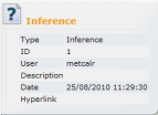
Enhancement to display of database item details in Explorer Window
|
A new column has been added to theExplorer Window when details are displayed. The ID column displays the item identifier (as displayed in the item's Properties Dialog). The ID is also displayed in the item tooltip. In addition an improvement has been made to the tooltip displayed from the Master Database icon in the tree view: the tooltip now displays information including the database path and GUID. See the Explorer Window topic for more information. |
|
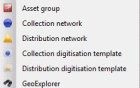
Improvement to display of Asset Groups in Explorer Window
|
When a Asset Group contains only one type of object, the Asset Group icon is changed slightly to reflect that single contained type. For example: the Ground Model and The purpose of this functionality is to allow groups in the tree to be identified more easily. |
|
Usability enhancement to object creation in the Explorer Window
|
Images have been added to the new object sub-menu (displayed by right clicking on a Asset group in the tree and selecting New from the context menu). This functionality aids the user in finding the object type to be created quickly without the need to read through the object list. |
Improvement to managing ranged themes
An improvement has been made to the Layer Theme Editor to allow theme ranges to be added or removed quickly. Hold down the  buttons to add or remove multiple ranges.
See the Managing Themes section for further information on themes.
Area Measurement using the Distance Tool
The Distance Estimation Tool  selectable from the GeoPlan Tools Toolbar has been enhanced to allow measurement of area in addition to length.
Using the distance tool, click on the GeoPlan around the area to be measured, hold down the CTRL key and double-click to link the last click point to the first click point. The polygon formed will be displayed briefly on the GeoPlan. The area of the polygon will be displayed in the status bar  .
.
Data Flag codes increased to four characters
In previous versions of InfoNet, data flag codes were restricted to two characters.
In this version it is possible to specify data flag codes of up to four characters.
See the Data Flags topic for further details.
Find and Replace Flags functionality
It is now possible to search for specific flags and replace the occurrences of these flags with other flags. This functionality can be used to update the flags of an imported network that was originally created using a different flagging system to the one used in the current database.
See the Data Flags and Find and Replace Flags Wizard topics for details.
Selection tool double-click functionality extended
Double-clicking on a single network object when using the selection tool  on the GeoPlan View displays the property sheet for the object in addition to selecting the object.
This tool has now been extended to work when multiple objects are clicked on, (when objects overlay each other for example). Clicking on the objects displays a Multiple Selection Dialog. Selecting an item from the Multiple Selection Dialog selects the object in the GeoPlan when using a single click (as in previous versions). When using a double-click the property sheet is also displayed for the selected object.
The tool can also now be used in the Long Section Window and the 3D Network Window.
Backspace shortcut to clear current selection
It is now possible to use the Backspace key as a shortcut to clear the current selection in the GeoPlan View.
Esc can also be used, however this will also revert the mode to Selection mode when using tools other than the select tool.
Ability to change GIS layer selection colour
A new GIS Layer selection colour option has been added to the Visual Page of the GeoPlan Properties Dialog. This option allows the highlighting colour for objects found using the GIS Find or Street Find functionality to be changed.
Implementation of filters to fine tune comparison of version control items
Optional filters have been implemented in the Comparison dialog to help filter out the differences to be reported during the comparison of version controlled items. Users of InfoWorks CS, SD, RS and WS will be familiar with the Ignore flags and Ignore defaults options. A new option, Use display precision, to be used to ignore differences that are below the level of precision shown in the object property sheets or grids, has been introduced.
When implemented, this functionality produces less cluttered outputs (screen, text file, CSV file or none) by hiding differences that can be perceived as more trivial.
See Comparison Dialog and Comparing Version Controlled Items topics for more details on these filters.
Ability to copy commit history to clipboard
The ability to copy selected rows of the commit history to the clipboard has been implemented. Select one or more rows on the Commit History Dialog and right click to display the Copy selected items to clipboard option.
Emergency reset of user permissions
In the event that it is necessary to reset user permissions for a master database, it is now possible to add a user as an administrator to a database via an emergency reset file obtained from Innovyze.
See User Permissions for further details.
